The following link allows you to easily find your precinct and Constable by typing in your address:
Harris County Address Information Search
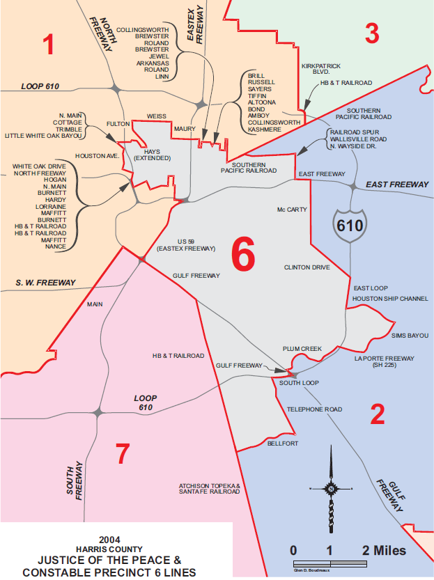
Jurisdiction Boundaries Description – Harris County Precinct 6. The map shows the boundaries of Harris County Constable Precinct 6 in relation to surrounding precincts labeled 1, 2, 3, and 7. Precinct 6 is centrally located in the southern and eastern portion of Harris County. The boundary is outlined in red and includes areas inside Loop 610 and extending southeast toward the Houston Ship Channel. The northern boundary of Precinct 6 generally follows areas near railroads and neighborhoods such as Kashmere Gardens and Fifth Ward, south of Loop 610 and east of Interstate 45 North. To the east, the boundary extends toward the East Freeway and along Loop 610 near the Houston Ship Channel and Sims Bayou. The southern boundary follows the South Loop and extends toward the Gulf Freeway, Telephone Road, and the Belfort area near SH 225. To the west, the boundary borders areas near Highway 288 and neighborhoods south of downtown Houston near Houston Avenue and White Oak Bayou. Major roadways include Interstate 10, Interstate 45, U.S. 59, Loop 610, Telephone Road, and Clinton Drive. Surrounding precincts include Precinct 1 to the northwest, Precinct 3 to the northeast, Precinct 2 to the southeast, and Precinct 7 to the southwest.